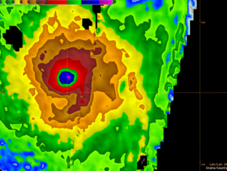
New potential for tracking severe storms
Even just within the last couple of months, Cyclones Fani, Idai and Kenneth have brought devastation to millions. With the frequency and severity of extreme weather like this expected to increase against the backdrop of climate change, it is more important than ever to forecast and track events accurately. And, an ESA satellite is helping with the task in hand.
SMOS meets ocean monsters
ESA’s SMOS and two other satellites are together providing insight into how surface winds evolve under tropical storm clouds in the Pacific Ocean. This new information could to help predict extreme weather at sea.
SMOS offers new perspective on hurricanes
With recent stories in the news about the devastation brought by hurricanes and typhoons to the US and Asia, we are reminded of how important it is to predict the paths of these mighty storms and also learn more about how they develop. Many satellites have eyes on storms, but ESA’s SMOS mission can offer an entirely new perspective.
Tracking Typhoon Hagibis from space
Hagibis was the biggest typhoon to hit Japan in decades. With extreme events like this likely to increase in number and in severity as a consequence of climate change, satellites are playing an increasingly important role in understanding and tracking huge storms.
SMOS sees triple superstorms
ESA’s versatile water mission tracked Asia’s recent storms over land and sea.
SMOS water mission turns hurricane hunter
ESA’s Earth Explorers have again shown how they are surpassing expectations. Designed to map soil moisture and ocean salinity, the versatile SMOS satellite has demonstrated that it can also offer unique information to improve hurricane forecasts.


